
Файл:Maggiolo - Portolankarte - 1541.png
Алдын ала көрүүнүн көлөмү: 800 × 524 пиксел Башка уруксаттар: 320 × 210 пиксел | 640 × 420 пиксел | 1 024 × 671 пиксел | 1 312 × 860 пиксел.
Асыл нуска файлы (1 312 × 860 пиксель, файлдын көлөмү: 2,21 MB, MIME түрү: image/png)
Жыйынтыгы
| Сыпаттама |
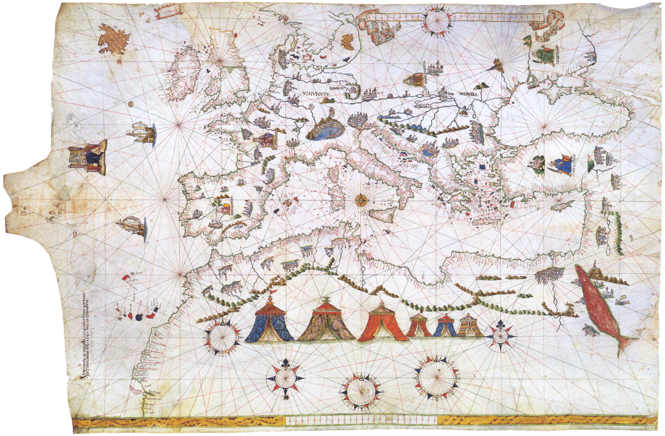
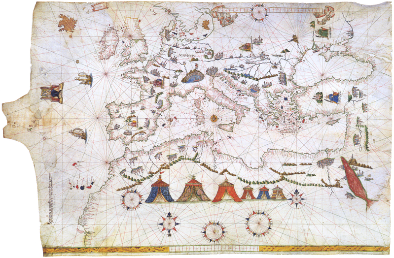
Deutsch: Vesconte Maggiolo, Portolankarte (1541)
Français : Portulan de Vesconte Maggiolo (1541) Europe, Méditerranée et Afrique du Nord |
||||||||||||||||||||||
| Дата | |||||||||||||||||||||||
| Булак | Kartenabteilung der Staatsbibliothek zu Berlin] | ||||||||||||||||||||||
| Автор |
|
||||||||||||||||||||||
| Башка нускалар | Derivative works of this file: Maggiolo - Portolankarte - 1541 Black Sea.PNG | ||||||||||||||||||||||
Лицензиялоо
|
This is a faithful photographic reproduction of a two-dimensional, public domain work of art. The work of art itself is in the public domain for the following reason:
The official position taken by the Wikimedia Foundation is that "faithful reproductions of two-dimensional public domain works of art are public domain".
This photographic reproduction is therefore also considered to be in the public domain in the United States. In other jurisdictions, re-use of this content may be restricted; see Reuse of PD-Art photographs for details. | ||||
Файлдын тарыхы
Файлдын белгилүү бир учурдагы көрүнүшүн көрүү үчүн тийиштүү убакыт/датаны басыңыз
| Убакыт/дата | Миниатюра | Өлчөм | Колдонуучу | Түшүндүрмө | |
|---|---|---|---|---|---|
| учурдагы | 20:01, 23 июнь 2018 | | 1 312 × 860 (2,21 MB) | SteinsplitterBot | Bot: Image rotated by 270° |
| 10:00, 11 декабрь 2015 |  | 860 × 1 312 (2,22 MB) | SteinsplitterBot | Bot: Image rotated by 90° | |
| 09:36, 14 сентябрь 2005 |  | 1 312 × 860 (2,33 MB) | Frank Schulenburg | ||
| 09:03, 14 сентябрь 2005 |  | 1 312 × 860 (2,37 MB) | Frank Schulenburg | Vesconte Maggiolo, Portolankarte (1541) Category:16th century maps |
Шилтемелер
Бул файл төмөнкү баракта колдонулат:
Файлдын глобалдык колдонулушу
Бул файл төмөнкү викилерде колдонулат:
- ar.wikipedia.org сайтындагы колдонулушу
- bg.wikipedia.org сайтындагы колдонулушу
- ca.wikipedia.org сайтындагы колдонулушу
- de.wikipedia.org сайтындагы колдонулушу
- el.wikipedia.org сайтындагы колдонулушу
- en.wikipedia.org сайтындагы колдонулушу
- es.wikipedia.org сайтындагы колдонулушу
- fr.wikipedia.org сайтындагы колдонулушу
- he.wikipedia.org сайтындагы колдонулушу
- hy.wikipedia.org сайтындагы колдонулушу
- is.wikipedia.org сайтындагы колдонулушу
- no.wikipedia.org сайтындагы колдонулушу
- nrm.wikipedia.org сайтындагы колдонулушу
- oc.wikipedia.org сайтындагы колдонулушу
- sl.wikipedia.org сайтындагы колдонулушу