
Файл:Portugal location map.svg

Size of this PNG preview of this SVG file: 313 × 600 пиксел. Башка уруксаттар: 125 × 240 пиксел | 250 × 480 пиксел | 400 × 768 пиксел | 534 × 1 024 пиксел | 1 068 × 2 048 пиксел | 612 × 1 173 пиксел.
Түп нуска файл (SVG файл, шарттуу түрдө 612 × 1 173 пиксел, файлдын өлчөмү: 211 KB)
Oi a cidade de Vizeu .
Жыйынтыгы
| Сыпаттама |
Deutsch: Positionskarte von Portugal
Quadratische Plattkarte, N-S-Streckung 130 %. Geographische Begrenzung der Karte:
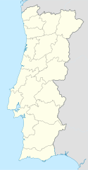
English: Location map of Portugal
Equirectangular projection, N/S stretching 130 %. Geographic limits of the map:
Español: Mapa de Portugal con los 18 distritos delimitados
Proyección cilíndrica equidistante, N/S alargamiento 130 %. Límites geográficos del mapa:
Português: Mapa de Portugal com os 18 distritos delimitados, para uso em localizações geográficas
Projecção cilíndrica equidistante, N/S alongamento 130 %. Limites geográficos do mapa:
|
| Дата | 03-07-2008 |
| Булак | own work, using United States National Imagery and Mapping Agency data |
| Автор | NordNordWest |
| Башка нускалар |
Derivative works of this file: |

|
This map has been made or improved in the German Kartenwerkstatt (Map Lab). You can propose maps to improve as well.
|
Лицензиялоо
I, the copyright holder of this work, hereby publish it under the following licenses:

|
Permission is granted to copy, distribute and/or modify this document under the terms of the GNU Free Documentation License, Version 1.2 or any later version published by the Free Software Foundation; with no Invariant Sections, no Front-Cover Texts, and no Back-Cover Texts. A copy of the license is included in the section entitled GNU Free Documentation License. |
This file is licensed under the Creative Commons Attribution-Share Alike 3.0 Unported license.
- Сиз буларга эркинсиз:
- бөлүшүү – чыгарманы көчүрүү, жайылтуу жана өткөрүп берүү
- ремикс кылуу – чыгарманы ылайыкташтыруу
- Төмөнкү шарттарда:
- атрибуция – Сиз тийиштүү насыя берип, лицензияга шилтеме калтырып жана өзгөртүүлөр болсо көрсөтүшүңүз керек. Сиз муну кандайдыр бир акылга сыярлык жол менен жасай аласыз, бирок лицензиар сизди же сиздин колдонууңузду жактырган кандайдыр бир жол менен эмес.
- Бирдей шарттар боюнча бөлүшүү – If you remix, transform, or build upon the material, you must distribute your contributions under the same or compatible license as the original.
Сиз тандаган лицензияны тандай аласыз.
Файлдын тарыхы
Файлдын белгилүү бир учурдагы көрүнүшүн көрүү үчүн тийиштүү убакыт/датаны басыңыз
| Убакыт/дата | Миниатюра | Өлчөм | Колдонуучу | Түшүндүрмө | |
|---|---|---|---|---|---|
| учурдагы | 08:27, 29 август 2008 | | 612 × 1 173 (211 KB) | NordNordWest | |
| 18:29, 11 август 2008 |  | 306 × 586 (207 KB) | NordNordWest | ||
| 22:01, 2 июль 2008 |  | 306 × 586 (236 KB) | NordNordWest | {{Information |Description= {{de|Positionskarte von Portugal}} Quadratische Plattkarte, N-S-Streckung 130 %. Geographische Begrenzung der Karte: * N: 42.3° N * S: 36.7° N * W: 9.8° W * O: 6.0° W {{en|Location map of [[:en:Portugal|Por |
Шилтемелер
Бул файл төмөнкү баракта колдонулат:
Файлдын глобалдык колдонулушу
Бул файл төмөнкү викилерде колдонулат:
- af.wikipedia.org сайтындагы колдонулушу
- als.wikipedia.org сайтындагы колдонулушу
- am.wikipedia.org сайтындагы колдонулушу
- an.wikipedia.org сайтындагы колдонулушу
- Sacavém
- Lisbona
- Ericeira
- Mafra
- Sintra
- Braga
- Coimbra
- Évora
- Aveiro
- Guarda (Portugal)
- Leiria
- Setúbal
- Almada (Portugal)
- Miranda de l Douro
- Bumioso
- Sines
- Porto
- Estádio do Dragão
- Seu de Porto
- Cascais
- Guimarães
- Lousã
- Miranda do Corvo
- Pampilhosa da Serra
- Vila Nova de Gaia
- Pavilhão João Rocha
- Elvas
- Ponte de Sor
- Portalegre
- Plantilla:Mapa de localización Portugal
- ar.wikipedia.org сайтындагы колдонулушу
- az.wikipedia.org сайтындагы колдонулушу
Бул файлдын глобалдык колдонулушун көрүү.