
Файл:Map of Eastern Siberia.png

Түп нуска файл (1 541 × 982 пиксель, файлдын өлчөмү: 2,74 MB, MIME түрү: image/png)
Жыйынтыгы
| Сыпаттама |
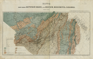
English: Map of the Southern Half of Eastern Siberia and Parts of Mongolia, Manchuria, and Sakhalin: For a General Sketch of the Orography of Eastern Siberia.
Русский: Кропоткин П. А. Карта южной половины Восточной Сибири, части Монголии: к Общему Очерку Орографии Восточной Сибири. Зап. по Общ. Геогр. т. 5. СПб.: [1875], Лит. Н. Брезв. 1 л.: цв. 48х76 см. |
| Дата | |
| Булак | http://www.wdl.org/en/item/125/ |
| Автор | Peter Kropotkin |
Лицензиялоо
|
This work is in the public domain in its country of origin and other countries and areas where the copyright term is the author's life plus 70 years or fewer.
| |
| This file has been identified as being free of known restrictions under copyright law, including all related and neighboring rights. | |
Файлдын тарыхы
Файлдын мурдагы нускасын көрүү үчүн тийиштүү убакыт/датаны басыңыз
| Убакыт/дата | Миниатюра | Өлчөм | Колдонуучу | Түшүндүрмө | |
|---|---|---|---|---|---|
| учурдагы | 15:49, 20 ноябрь 2011 | | 1 541 × 982 (2,74 MB) | Koroesu | {{Information |Description ={{en|1=Map of the Southern Half of Eastern Siberia and Parts of Mongolia, Manchuria, and Sakhalin: For a General Sketch of the Orography of Eastern Siberia.}} |Source =http://www.wdl.org/en/item/125/ |Author |
Шилтемелер
Бул файл төмөнкү баракта колдонулат:
Файлдын глобалдык колдонулушу
Бул файл төмөнкү викилерде колдонулат:
- ar.wikipedia.org сайтындагы колдонулушу
- az.wikipedia.org сайтындагы колдонулушу
- ba.wikipedia.org сайтындагы колдонулушу
- bg.wikipedia.org сайтындагы колдонулушу
- ca.wikipedia.org сайтындагы колдонулушу
- ce.wikipedia.org сайтындагы колдонулушу
- da.wikipedia.org сайтындагы колдонулушу
- de.wikipedia.org сайтындагы колдонулушу
- en.wikipedia.org сайтындагы колдонулушу
- eo.wikipedia.org сайтындагы колдонулушу
- et.wikipedia.org сайтындагы колдонулушу
- fa.wikipedia.org сайтындагы колдонулушу
- fi.wikipedia.org сайтындагы колдонулушу
- fr.wikipedia.org сайтындагы колдонулушу
- gl.wikipedia.org сайтындагы колдонулушу
- hy.wikipedia.org сайтындагы колдонулушу
- id.wikipedia.org сайтындагы колдонулушу
- no.wikipedia.org сайтындагы колдонулушу
- pl.wikipedia.org сайтындагы колдонулушу
- ru.wikipedia.org сайтындагы колдонулушу
- sk.wikipedia.org сайтындагы колдонулушу
- sv.wikipedia.org сайтындагы колдонулушу
- tr.wikipedia.org сайтындагы колдонулушу
- uk.wikipedia.org сайтындагы колдонулушу