
Файл:Westbengalimap.png

Учурда көрсөтүлүүчү өлчөм: 668 × 600 пиксел Башка уруксаттар: 267 × 240 пиксел | 535 × 480 пиксел | 764 × 686 пиксел.
Түп нуска файл (764 × 686 пиксель, файлдын өлчөмү: 278 KB, MIME түрү: image/png)
Жыйынтыгы
| Сыпаттама |
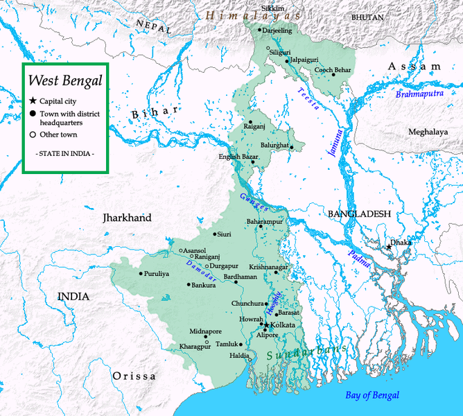
English: Map of West Bengal |
| Дата | |
| Булак | Self-made; base map from demis.nl, outline map (Image:West Bengal outline map.svg by w:user:Planemad. |
| Автор | Zakuragi |
Лицензиялоо
I, the copyright holder of this work, hereby publish it under the following licenses:
This file is licensed under the Creative Commons Attribution-Share Alike 3.0 Unported, 2.5 Generic, 2.0 Generic and 1.0 Generic license.
- Сиз буларга эркинсиз:
- бөлүшүү – чыгарманы көчүрүү, жайылтуу жана өткөрүп берүү
- ремикс кылуу – чыгарманы ылайыкташтыруу
- Төмөнкү шарттарда:
- атрибуция – Сиз тийиштүү насыя берип, лицензияга шилтеме калтырып жана өзгөртүүлөр болсо көрсөтүшүңүз керек. Сиз муну кандайдыр бир акылга сыярлык жол менен жасай аласыз, бирок лицензиар сизди же сиздин колдонууңузду жактырган кандайдыр бир жол менен эмес.
- Бирдей шарттар боюнча бөлүшүү – If you remix, transform, or build upon the material, you must distribute your contributions under the same or compatible license as the original.

|
Permission is granted to copy, distribute and/or modify this document under the terms of the GNU Free Documentation License, Version 1.2 or any later version published by the Free Software Foundation; with no Invariant Sections, no Front-Cover Texts, and no Back-Cover Texts. A copy of the license is included in the section entitled GNU Free Documentation License. |
Сиз тандаган лицензияны тандай аласыз.
This image is in the public domain because it came from the site https://www.demis.nl/products/web-map-server/examples/ and was released by the copyright holder. Permission is granted to copy, distribute and/or modify this map since it is based on free of copyright images from: www.demis.nl. See also approval email on de.wp and its clarification.
|
| This work has been released into the public domain by its copyright holder, www.demis.nl. This applies worldwide. In some countries this may not be legally possible; if so: www.demis.nl grants anyone the right to use this work for any purpose, without any conditions, unless such conditions are required by law.
|
Файлдын тарыхы
Файлдын мурдагы нускасын көрүү үчүн тийиштүү убакыт/датаны басыңыз
| Убакыт/дата | Миниатюра | Өлчөм | Колдонуучу | Түшүндүрмө | |
|---|---|---|---|---|---|
| учурдагы | 21:23, 15 июнь 2008 | | 764 × 686 (278 KB) | Tonym88~commonswiki | {{Information |Description={{en|1=Map of West Bengal}} |Source=Self-made; base map from [http://www.demis.nl/wms/mapclip.htm demis.nl], outline map (Image:West Bengal outline map.svg by w:user:Planemad. |Author=Zakuragi |Dat |
Шилтемелер
Бул файл төмөнкү баракта колдонулат:
Файлдын глобалдык колдонулушу
Бул файл төмөнкү викилерде колдонулат:
- ang.wikipedia.org сайтындагы колдонулушу
- ar.wikipedia.org сайтындагы колдонулушу
- en.wikipedia.org сайтындагы колдонулушу
- hu.wikipedia.org сайтындагы колдонулушу
- it.wikipedia.org сайтындагы колдонулушу
- ml.wikipedia.org сайтындагы колдонулушу
- mn.wikipedia.org сайтындагы колдонулушу
- ru.wikipedia.org сайтындагы колдонулушу
- xmf.wikipedia.org сайтындагы колдонулушу