
Файл:Saxony-Anhalt location map.svg

Size of this PNG preview of this SVG file: 509 × 600 пиксел. Башка уруксаттар: 204 × 240 пиксел | 407 × 480 пиксел | 652 × 768 пиксел | 869 × 1 024 пиксел | 1 738 × 2 048 пиксел | 1 957 × 2 306 пиксел.
Түп нуска файл (SVG файл, шарттуу түрдө 1 957 × 2 306 пиксел, файлдын өлчөмү: 1,27 MB)
Жыйынтыгы
| Сыпаттама |
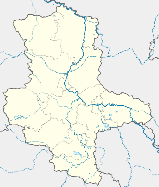
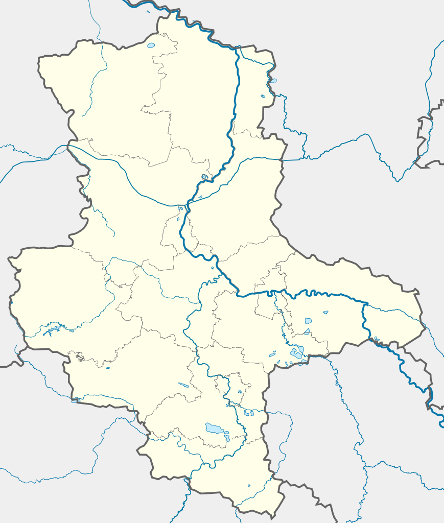
Deutsch: Positionskarte Sachsen-Anhalt, Deutschland. Geographische Begrenzung der Karte:
English: Location map Saxony-Anhalt, Germany. Geographic limits of the map:
|
| Дата | |
| Булак |
own work, templates |
| Автор | TUBS |
| Башка нускалар |
Derivative works of this file: Karte VTO 2012 under CC-by-sa.png
|

| Open this image as an overlay in Google Earth (Google Maps, Bing) | (Help|Source) |
Лицензиялоо
I, the copyright holder of this work, hereby publish it under the following licenses:

|
Permission is granted to copy, distribute and/or modify this document under the terms of the GNU Free Documentation License, Version 1.2 or any later version published by the Free Software Foundation; with no Invariant Sections, no Front-Cover Texts, and no Back-Cover Texts. A copy of the license is included in the section entitled GNU Free Documentation License. |
This file is licensed under the Creative Commons Attribution-Share Alike 3.0 Unported, 2.5 Generic, 2.0 Generic and 1.0 Generic license.
- Сиз буларга эркинсиз:
- бөлүшүү – чыгарманы көчүрүү, жайылтуу жана өткөрүп берүү
- ремикс кылуу – чыгарманы ылайыкташтыруу
- Төмөнкү шарттарда:
- атрибуция – Сиз тийиштүү насыя берип, лицензияга шилтеме калтырып жана өзгөртүүлөр болсо көрсөтүшүңүз керек. Сиз муну кандайдыр бир акылга сыярлык жол менен жасай аласыз, бирок лицензиар сизди же сиздин колдонууңузду жактырган кандайдыр бир жол менен эмес.
- Бирдей шарттар боюнча бөлүшүү – If you remix, transform, or build upon the material, you must distribute your contributions under the same or compatible license as the original.
Каалаган лицензияны тандай аласыз.
Файлдын тарыхы
Файлдын мурдагы нускасын көрүү үчүн тийиштүү убакыт/датаны басыңыз
| Убакыт/дата | Миниатюра | Өлчөм | Колдонуучу | Түшүндүрмө | |
|---|---|---|---|---|---|
| учурдагы | 17:14, 22 сентябрь 2009 | | 1 957 × 2 306 (1,27 MB) | Alexrk2 | Darstellungsreihenfolge Flüsse,Seen |
| 16:15, 22 сентябрь 2009 |  | 1 957 × 2 306 (1,26 MB) | Alexrk2 | Landesgrenze korr. | |
| 09:26, 2 февраль 2009 |  | 1 957 × 2 306 (875 KB) | TUBS | rivers aside district borders. +Wasserstraßenkreuz Magdeburg | |
| 01:22, 31 январь 2009 |  | 1 957 × 2 306 (872 KB) | TUBS | corrected some rivers outside state of Saxony-Anhalt | |
| 22:07, 29 январь 2009 |  | 1 957 × 2 306 (845 KB) | TUBS | thinner stroke weights | |
| 21:46, 29 январь 2009 |  | 1 957 × 2 306 (845 KB) | TUBS | == Summary == {{Information |Description= {{de|Positionskarte Sachsen-Anhalt, Deutschland. Geographische Begrenzung der Karte:}} {{en|Location map Saxony-Anhalt, Germany. Geographic limits of the map:}} * N: |
Шилтемелер
Бул файлды колдонгон барактар жок.
Файлдын глобалдык колдонулушу
Бул файл төмөнкү викилерде колдонулат:
- ar.wikipedia.org сайтындагы колдонулушу
- azb.wikipedia.org сайтындагы колдонулушу
- ba.wikipedia.org сайтындагы колдонулушу
- Цербст (ҡала)
- Дессау
- Виттенберг
- Вернигероде
- Кётен
- Ильзенбург (Гарц)
- Плёцкау
- Хойккевальде
- Хакеборн
- Либехна
- Шёнебек (Эльба)
- Вольферштедт
- Кольбиц
- Фрисдорф
- Зиштедт
- Зальцмюнде
- Офельгюнне
- Коббельсдорф
- Цетлинген
- Шлагентин
- Илевиц
- Гольдшау
- Хаймбург
- Бухгольц (Альтмарк)
- Веспен (Бёрде)
- Шоллене
- Рагун
- Хельбра
- Кверфурт (Германиялағы ҡала)
- Гросмюлинген
- Веддерслебен
- Кюттен (Саксония-Анхальт)
- Хоэнтрам
- Таугвиц
- Хедерслебен (Мансфельд)
- Кальбе (Заале)
- Карсдорф
- Ауслебен
- Зоммерсдорф
- Зеебенау
- Дёбрис
- Заубах
- Хеклинген
- Цимендорф
- Турланд
- Харслебен
Бул файлдын глобалдык колдонулушун көрүү.